If you are telling a story and purposefully avoid making any reference to the “where” of the events—its location, characters’ movements in the space, changes of
that space over time—there’s a good chance your listener will feel confused and alienated from the story you are trying to tell. Physical spatial relationships are
essential to how we understand actualities, and sometimes the spatial configuration
of events can tell intricate tales that text, sound and image can not. During the
first half of the spring semester, the GIS (geographic information system) lab was home
to a new, 1-credit course, DS 116 Storytelling: Mapping, which focused on using spatial data in a map format to construct digital storytelling platforms.The six-student class was taught by Professor Tom Hart, a lecturer in the Environmental Studies and Sciences Department.

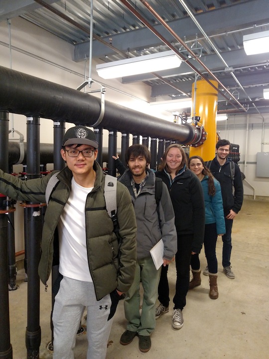
DS 119 students visiting the control hub for the Arts
Quad geothermal field (photo by Tom Hart)
Hart, who teaches introductory and advanced GIS and spatial analysis courses, had experience working with digital platforms to present his research and findings and saw that, at Skidmore, this skill wasn’t being taught.
“In a lot of the GIS classes we don’t go that next step of actually publishing things online,” he said.
The class combined lecture and lab; certain concepts of the medium were explored and then these concepts and skills were used in approaching how to present different data sets.
Starting with examples of existing story maps, such as those produced for the Flint water crisis or the 2017 women’s
march, the class learned some of the intricacies of effective spatial storytelling
and was able to engage with several online mapping services such as Google Maps, Silk
and ArcGIS Online.After the initial study of the particulars of mapping as a medium, the class was given a project that was relevant to the space of Skidmore campus as a way to
demonstrate, practice, and refine these skills.
The students studied and amassed relevant information to show Skidmore’s growing network
of geothermal systems—a network which, given its underground nature, can often be
hard to visualize and understand with language alone. Why this project? Says Hart,
“I look for things that are especially relevant, things that are timely that are going
to work well or have the potential to work well with engaging students. It was hard
not to see the geothermal wells going in [behind Palamountain Hall] over the summer"
of 2016.
Since the class lasted only half a semester and was primarily oriented toward producing
a robust end result, the class worked together in a unique way. “One of the things
that I did was that I did not ask for prerequisites of knowing GIS, so the design
of the class was as if it were a small startup company,” Hart said. This meant that
some students who were versed in the use of the GIS application could focus their
energies there, while other students could apply their strengths to other necessary
components.
Jacqueline Carames ’16 had taken GIS classes since her sophomore year and had had
several internships that made her familiar with the medium. With the fresh approach
toward mapping as a storytelling technique, Carames was able to use her skills for
an entirely new application. She plans on using several techniques and concepts in
her upcoming environmental studies capstone project.
“It was really interesting that it was kind of, you go into it and learn what you
want to learn and take away what you want to take away,” Carames said.
While some students focused on creating the map images, others focused on researching
Skidmore’s geothermal projects and how to best embed this information into the various
story maps. In order to develop each strand of the project, the class had to have
a high level of communication between students; the class would often close with a
round-robin discussion of what has been accomplished, what needs to be done and how
best to achieve the class’s goals.
“Given the opportunity, the students really did demonstrate independence and the ability
to take their own thoughts and direct where the project was going,” Hart said. “In
the best of circumstances that’s the outcome that you’d want: I become a teacher to
begin with to show what’s possible and then a facilitator in the end so that each
person could act on their own initiative and their own thoughts.”
—Adam Simon '19 philosophy
DS 116A: Storytelling: Mapping will be offered again in fall 2017.

