Visual Landscape and Land Use Change Project
Nicholas Liu-Sontag, Karen Kellogg and Alex Chaucer
Summer 2010
The Visual Landscape and Land Use Change Project is an online visual database of historical aerial photographs and paired historical and modern day photographs.
 |
 |
| Rephotographs | Aerial Photographs |
The Saratoga Lake watershed has undergone many transitions over the past 150 years driven by agriculture, industry, recreation, tourism, and urban development.
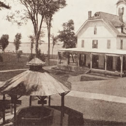
We aimed to capture the resulting landscape changes using historical photographs and rephotographed modern day views. By collecting historical images, determining their locations, and returning to the same sites, we took close to exact contemporary views, creating a clear “then and now” perspective. This work complements a series of aerial photographs taken of the watershed in the 1940s, 1960s, and 1980s.
| Special thanks to our collaborators within the Saratoga community: Brookside Museum & The Saratoga County Historical Society The Saratoga Springs History Museum The Greenfield Historical Society Saratoga County Soil and Water Conservation District |