
GIS Mapping Projects
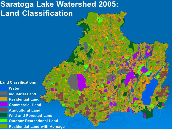 Saratoga Lake Watershed Land Use 2005
Cortlandt Toczylowski and Katie Bronson
This map shows various land use patterns in the Saratoga Lake watershed. The catagories used include: industrial, residential, commercial, agricultural, wild and forested, recreational, and residential with acreage.
 Roads Intersecting with Waterways
Allison Gillum and Allison Stafford
This map shows where roadways cross streams in the Saratoga Lake watershed. It shows where all of these sites are and indicates which sites were used as sample sites. The total distance of these intersections in the watershed was found to be 4.2 miles.
 Stream Straightening from Roads
Allison Gillum and Allison Stafford
This map shows the stream sections in the Saratoga Lake Watershed which have been straightened for roadways. The total length of stream effected by this was found to be 8.5 mi.