By Theme:Arts and Literature | Campus Sustainability | Community Perspectives | Development | Economic Analysis | Ecosystem Analysis | Education | Energy | Environmental Justice | Food Systems | Geology of the Watershed | Green Architecture | Green Business | History of the Watershed | Invasive Species | Land Use Patterns | Public Policy | Recreation | Transportation | Water Quality
History of the Watershed
 The History of the Kayaderosseras Watershed: An Environmental Approach
Jon DeCoste and Conor Taff (2005)
Using various archival sources, a history of the Kayaderosseras watershed was constructed starting before European settlement and proceeding into the 20th century. The goal of this project is to illuminate historical trends and changes that have shaped the environment that we see today and to provide valuable insight into future monitoring and planning.
 What to do about a Drought in a Bout of Drought: Understanding Drought in a Water-Rich
Region
What to do about a Drought in a Bout of Drought: Understanding Drought in a Water-Rich
Region
Andy Hart and Kate Stevens (2008)
This study explores the causes of drought in Saratoga and how the city responds to instances of drought. Our results reveal that drought in Saratoga can be affected by precipitation, population growth, water consumption, and Loughberry Lake’s storage capacity. Drawing from interviews with Public Works officials, we learn that the city manages small drought periods with mainly reactive responses. In order for the city to have a genuine proactive drought management policy, a larger water source with more storage capacity is needed to both store water and provide guaranteed water for the citizens of Saratoga in a time of severe drought.
Full report is not available. Please contact Bob Turner for more information.
 A Survey of the Surficial and Bedrock Geology of the Kayaderosseras Watershed
Conor Taff '05 (2005)
The aim of this project was to provide a basic GIS database of relevant maps and layers
of the Kayaderosseras watershed as a foundation for future WRI research. Detailed
maps and layers of the Kayaderosseras watershed were created, including subwatershed
divisions, topography, municipal boundaries, land use, roadways, bedrock geology and
surficial geology. This project also includes an overview of the geologic history
of Kayaderosseras watershed.
 Early Meanings of the Hudson River
Megan McAdams '08 and Rik Scarce, Department of Anthropology (2006)
From its discovery by Henry Hudson in 1609, the Hudson River landscape's meanings changed dramatically and repeatedly throughout history. Our project's goal was to develop a theory to describe the earliest of those shifting meanings and to explain the forces that gave rise to them. Our fundamental theoretical observation is that power, in some form, was dependent upon the Hudson River landscape. In that sense, the landscape, not human culture, was the ultimate arbiter of meaning in the Hudson's earliest recorded periods.
Full report is not available. Please contact Rik Scarce for more information.
 Crooked Waters: A History of Riparian Conflict in the Kayaderosseras Watershed
Nadine Dodge '10, Brad Nesbitt '09, Karen Kellogg, Environmental Studies Program, and Michael Ennis-McMillan, Department of Anthropology (2007)
As industry and population burgeoned within the Kayaderosseras Creek watershed throughout the 19th century, tensions among the stakeholders of this shared resource also heightened. Manufacturers began to use the creek as a secondary resource. Those who still relied on the water as a primary resource suffered from the water's altered flow and diminished quality. Common law and government legislation proved an often unreliable means of enforcing pollution control. The early water conflicts in the Kayaderosseras watershed demonstrate the prominent role of water in community development, discussion, and debate.
Full report is not available. Please contact Karen Kellogg for more information.
 Logging, Dams, and Jams: What Was the Geomorphic Impact of Adirondack Logging on Hudson
River Headwater Streams?
Logging, Dams, and Jams: What Was the Geomorphic Impact of Adirondack Logging on Hudson
River Headwater Streams?
Matthew Shrensel ’09 and Kyle Nichols, Associate Professor of Geosciences (2008)
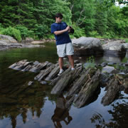
Adirondack logging from the early 1800s-1950 used waterways to drive logs through terrain too rugged and remote for overland transport. To facilitate log transport, dams were constructed to release water during spring melt. Such an increase of peak discharge may have had a lasting effect on drainage morphology and sediment distribution. Our goal was to develop a database of logging dams that were used during this time. We used several different means to acquire dam locations such as: literature, interviews with local ‘experts’, classifieds and web forums, and developing our own criteria based on basin morphology from topographic maps and aerial photographs. To date we have over 80 confirmed and potential sites.
 Capturing and Preserving History in the Upper Hudson River Valley: Development of
a Historic Map Database Using Geographic Information Systems
Capturing and Preserving History in the Upper Hudson River Valley: Development of
a Historic Map Database Using Geographic Information Systems
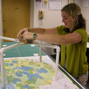
Lyndsay Strange ’09 and Alex Chaucer, GIS Instructional Technologist (2008)
The Upper Hudson River valley has a rich history of industrial, commercial, residential and recreational impacts at different stages in time throughout the watershed. When studying this geographic area there currently is no centralized resource to suggest watershed impacts organized in a temporal and geographical context. Historic maps contain much of this valuable reference information, yet there is no centralized resource for searching these documents, and often access involves a physical visit to view the document. By contacting private collectors and public libraries’ archives, we are able to locate and access fragile historic maps. This projects aims to collect this historic cartographic information digitally, reference it geographically, maintain it centrally, and present this information in usable format for future research purposes.
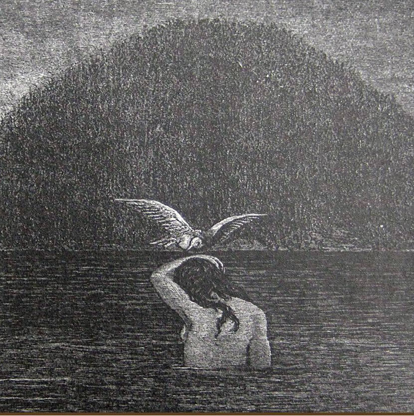 Place of the Swift Waters: A History of the First People of the Saratoga Lake Watershed
Jenna Gersie and Malone Matson (2010)
We examined a history of the native people of the Saratoga Lake Watershed, beginning with archaeological evidence from 12,000 years ago and focusing on the time surrounding early European contact. Though many New England tribes such as the Mahican used the lands in this area, we explored the ways that the Mohawk people in particular related to water in terms of food resources, including fishing, hunting, and agriculture; travel, trade, and warfare along the area's waterways; the medicinal springs of Saratoga; spirituality and culture; and current water-use issues.
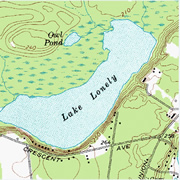 Nitrogen and sediment dynamics in wetlands and streams along an urbanization gradient
within the Lake Lonely watershed
Nitrogen and sediment dynamics in wetlands and streams along an urbanization gradient
within the Lake Lonely watershed
Ben Freiberg, Nicolas Graver, & Kat Klammer (2016)
The ability of wetlands to sequester or convert reactive nitrogen is an important control of anthropogenic nutrient inputs. We observed cool weather nitrous oxide flux, denitrification potential, nitrogen mineralization rates, and sediment patterns within two New York wetland streams. The N2O flux and N-mineralization rates had no significant relationships to temperature. The size of sediments and thus availability of denitrifying bacteria habitat may determine rates of microbial nitrate processing within wetland streams.
Full report is not available. Please contact Karen Kellogg for more information.